
Sarawak joined North Borneo (Sabah), Singapore, and the Federation of Malaya to form the Federation of Malaysia on 16th September 1963. After 59 years, how much do you, the average Malaysian, know about Sarawak? Do share these fun facts with your friends!
Sarawak (124,450 km2) is 95.3% the size of Peninsular Malaysia (130,590 km2) or 37.8% Malaysia’s land area. It is as large as the whole of West Malaysia minus Negeri Sembilan state (6,658 km2). Sabah (73,620 km2) is 22.4% Malaysia, the second in size.
The Sarawak population in 2020 was 2,560,600 (Sarawak Facts and Figures 2021) or 8.1% of Malaysia (31.6 million in 2016 Malaysian Department of Statistics). It is the fourth most populous after Selangor, Perak and Sabah (3.8 million).
46% of the population in East Malaysia live widely scattered in the rural areas compared to 20% in Peninsular Malaysia and the national average of 29%. The population density is 95.7 persons per sq km in Peninsular Malaysia, 0.04 in Sarawak and 0.01 in Sabah.
The road network in Sarawak is under-developed. 50% of the roads in Sabah and 30% in Sarawak are gravel or earth roads. Existing road infrastructure mostly connect the towns along the coast. The Sarawak coastline is about 1,035 kilometers long, with its coastal marine habitats consisting of sandy beaches, mudflats, and rocky shores. Sarawak is one of the mega-diversity regions in the world.
The Malaysian section (2,083 km) of the Pan Borneo Highway connecting Sarawak (1,077 km) to Sabah (through Brunei) is part of the 5,324km Trans-Borneo Highway. The Pan-Borneo highway under construction will be the main road system connecting Sabah, Sarawak, Brunei and Kalimantan. The project includes the upgrading of roads from a two-lane single carriageway to a four-lane dual carriageway, modern bridges, rest and service areas, designated lay-bys, and interchanges. As of May 2022, the Sarawak section was 82% completed, and is projected to finish by 2028.
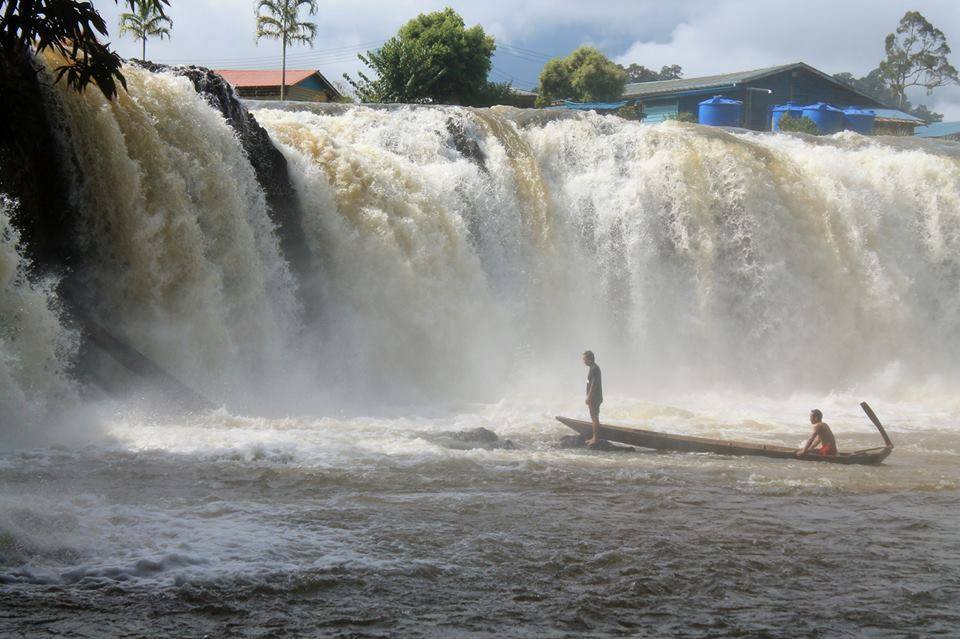
Sarawak has an extensive network of navigable rivers that form an inland waterway transport system. There are 35 gazetted rivers with a collective length of about 5,000 km, of which approximately 3,300 km are navigable. These connect the population living in the interior and along the coast and function like the roads and rails of Peninsular Malaysia. The rivers provide efficient passage for resources such as timber and other agricultural goods to reach international deep-water ports for export.
Sungai Rajang (567 km), the longest river in Sarawak and Malaysia, is the most important river in Sarawak. It powers three of the four hydroelectric stations in Sarawak, Bakun (2011), Murum (2014) and Balleh (for completion 2028). Malaysia’s largest and tallest (205 m) hydroelectric project, the Bakun Hydro Electric Dam Project, is located on the Balui River, one of its branches. Bakun is currently the third highest concrete face rock-fill dam in the world.
About 62% of the state land mass area is under forest cover (based on satellite imageries 2018). This, together with its rugged terrain, makes air transportation the only means of connecting remote, sparsely populated, or otherwise inaccessible parts with the rest of the country. For most part, the rural areas in Borneo can only be accessed by government-subsidised rural air services and by boat. These routes operate in 10 airports and 13 STOL ports within Sabah and Sarawak.
With the conditions on the ground, air travel is the only realistic choice and an important mode of transportation for the rural resident. From Marudi to Bario is four days by hazardous logging roads but a mere 40 minutes flight on the commercial 19-seater twin otter. Kuching to Sibu is 6 hours 30 minutes (by road); 4 hours 30 minutes (by express boat), and only 45 minutes by air.
Coming to Kuching / Sarawak (Sibu/ Miri/ Bintulu)
Sarawak has two international airports — Kuching and Miri — but international connectivity is still limited. Prior to Covid restrictions, for KIA, the only direct flights available were from Bandar Sri Begawan, Singapore and Pontianak while for MIA, Scoot Tigerair was the only airline offering two direct flights from Singapore to Miri per week.
Sabah with its only international airport in Kota Kinabalu has direct flights to more international destinations, including Bandar Sri Begawan, Tokyo (seasonal), Manila, Singapore, Busan, Seoul, and Taipei.
From West Malaysia, you can fly via Kuala Lumpur, Johor Bahru or Penang to Kuching, Miri and Kota Kinabalu. To Kuching, it only takes 1 hour 45 minutes from KLIA, 1 hr 15mins from Johor or Singapore. Kota Kinabalu direct flights are 1h 30mins. Pontianak to Kuching is a 50-minute flight or nine hours by bus. From Pontianak, I learned that you could board a boat to Dungun, Terengganu, and reach Kuala Lumpur by bus in 23 hours 40 minutes. Might be an option for those who really hate flying. Not sure if these are still operational, though.
For those who wish to make the Guinness Book of Records, they might try swimming across the South China Sea from Singapore (540 nautical miles) or Johor Port (518 nautical miles) to Kuching. Beware of pirates. The school of residential dolphins at the estuary of the Sarawak River will happily welcome you as will we. Kuching is about 60 km further inland up this river. I think there are crocodiles. Based on 2016 statistics, 13,500 crocodiles have been identified in more than 40 major rivers in Sarawak. Good luck.
Dr Tan Poh Tin is a paediatrician and public health specialist and is proudly Sarawakian.
- This is the personal opinion of the writer or publication and does not necessarily represent the views of CodeBlue.


